Junction of the Ring Road & Watling Street
Riding Gate was one of the original six main gates that formed part of the fortifications that the Romans built between AD250-270.
It is thought that the gate’s name is derived from the original red Roman bricks which gave it a red appearance.
When the adjacent roundabout was re-constructed in 1985, the Canterbury Archaeological Trust were able to investigate the site and they found the gate to have been monumental in size, two carriageways and two guard chambers; its size is put down to the fact that it was on the Watling Street, the main route from Dover to London.
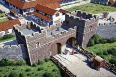
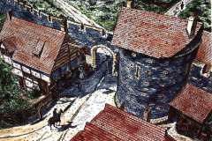
It seems that it was unnecessarily large as the excavations showed that the south gateway soon became disused and was blocked up; remains of the bottom of the gate and even the nails used in its construction were still in place when the Trust carried out their dig. The massive stone hinge points that allowed the gate to pivot were still in place and shown signs of the opening and closing of the gate. The Trust have produced possible reconstructions of what the gate might have looked like in the 3rd century (Image 1) and in the 18th century (Image 2).
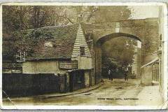
In the 11th century records show that St Edmund’s church was built on the southern carriageway and was only removed in 1349. The gateway was unblocked in 1430 only to be blocked again later that century. It was temporarily blocked again during Sir James Wyatt’s rebellion in 1553. It seems that the gateway caused problems as there are many references to its repair and improvement over the next 200 years. Clearly the Roman arch had fallen by this time as a timber bridge was built in 1576. When Alderman Simmons created the Dane John Gardens in 1791, he also built a brick arch over the gateway (Image 3). This image shows the Duke of York inn on the left, demolished 1882. Within 10 years a house had been built under it, leaving room only for pedestrians to pass.
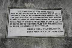
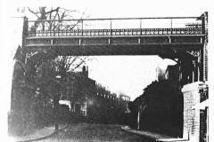
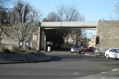
By 1884 a cast iron bridge, created by the Biggleston company, spanned the gateway as recorded on a plaque (Image 4), until 1942 when this area was damaged, along with adjacent sections of the city wall, during the wartime bombing. The damage was only repaired in 1970 when the present concrete bridge was built (Image 6), making it possible to walk along the walls again from Burgate to Worthgate. The unwanted iron bridge was removed to a new life in Heathfield Safari Park (East Sussex) where it forms part of a model railway track.
What to see:
- The layout of the Roman gateway set out in block work in the present road, now rather indistinct
- The present concrete bridge spanning over the road on the line of the City wall
Access: at all times – public road
Sources: Canterbury Archaeological Trust Annual report 1985; The Bigglestons of Canterbury (Oaten Hill & District Society, 1996); City Wall Trail (Canterbury City Council); The City Gates of Canterbury by Christopher Buckingham (thomas becket books, 1980)
AT
