We devote this page to new (2020) evidence concerning county borough boundary stones and GPO marker stones. These updates have two features in common: thay were spotted and reported by readers of the website; and they are interesting in that they differ from earlier versions or are hard to spot.
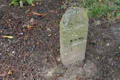
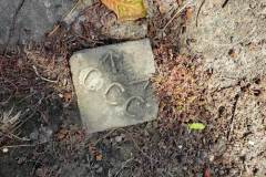
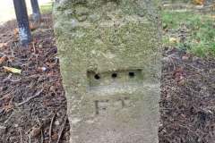
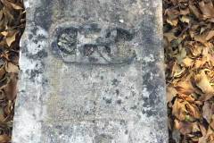
The first concerns two stones near the corner of Temple Road and Bishop’s Way, not far from the municipal cemetery (Images 1 to 3). The first of these, a GPO stone (Image 3) is a stone version (possibly a form of concrete) that was similar in purpose to metal versions noted elsewhere in this website. Like the metal versions, it lacks the metal insert that showed the distance (in feet) to a split in the underground phone cables. The nearby horizontal ‘CCC’ stone (Canterbury City Council) is a puzzle (Image 2). We’re not aware of anything similar elsewhere in the city, and we’re uncertain why it was placed here. Our thanks to a local resident for spotting these stones and reporting them to us; also to Clive Bowley, Joyce Ainslie, and BT Archives for help with interpreting them.
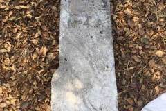
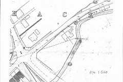
The second update relates to a ‘missing’ boundary stone of Canterbury County borough (Images 4 and 5). It was marked as stone number 4A, both on the stone and on the first very large scale (1:500) map of Canterbury, dated 1874. The map (Image 6) clearly shows that the stone then stood in the middle of the Great Stour river. Quite how it came to lie in a nearby garden is unclear. For more on other county borough boundary stones, click here. For a detailed mapping of the boundary, click here. Our thanks to local resident Philip Wilson for information on this stone.
DL
